
Peru Earthquake: Watch The Horrifying Moment A Massive 7.2 Magnitude Earthquake Struck Peru
Peru Earthquake: Watch The Horrifying Moment A Massive 7.2 Magnitude Earthquake Struck Peru
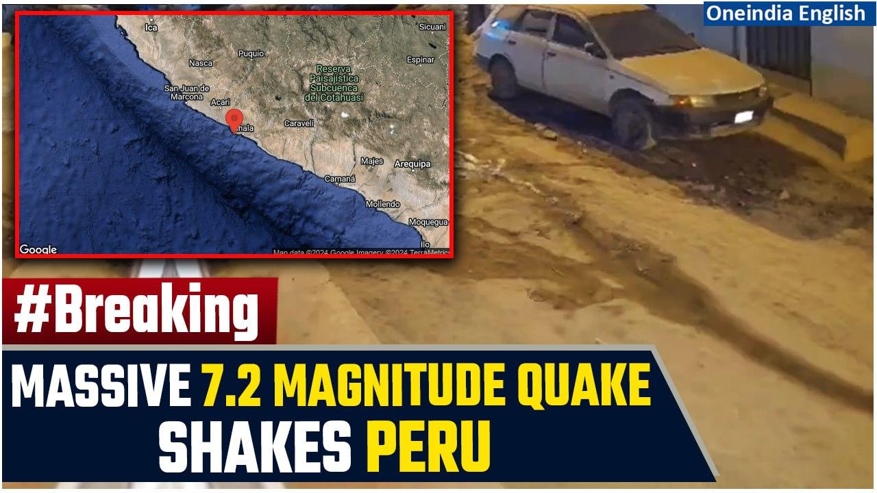
A magnitude 7.2 earthquake struck off the coast of central Peru on Friday, the United States Geological Survey said, with tsunami waves expected along some coastlines.
The USGS said the tremor hit 8.8 kilometres (5.5 miles) from Atiquipa district, raising an initial magnitude rating soon after the quake was reported.
The USGS said that strong shaking from the quake would have been felt in areas near the epicentre.
#PeruEarthquake #PeruEarthquakeVideo #EarthquakePeruVideo #Magnitude7Point2 #SeismicActivity #TsunamiWarning #EarthquakePeru #RingOfFire #NaturalDisaster #EpicenterAtiquipa #TsunamiWaves #EarthquakeFootage #PeruQuake #DisasterResponse #PacificRingOfFire #Seismology #EmergencyAlert ~PR.152~HT.318~GR.125~ED.102~

![Peruvian farmer takes German energy giant RWE to court in fight to hold polluters accountable [Video]](https://video.newsserve.net/300/v/20250317/1405299294-Peruvian-farmer-takes-German-energy-giant-RWE-to.jpg)
![Mall Roof Collapse in Peru Kills 6, Injures 78 – Tragedy in Real Plaza Trujillo Amid Friday Rush [Video]](https://video.newsserve.net/300/v/20250223/1403183938-Mall-Roof-Collapse-in-Peru-Kills-Injures.jpg)
![State of emegency declared as Nazca hit by severe flooding and landslides [Video]](https://video.newsserve.net/300/v/20250221/1402923710-State-of-emegency-declared-as-Nazca-hit-by.jpg)
![Illegal internet access at high security prison in Peru [Video]](https://video.newsserve.net/300/v/20250211/1401480958-Illegal-internet-access-at-high-security-prison-in.jpg)
![Peru Earthquake: Southern Peru Jolted by 7.2 Quake, Highway Damaged, No Tsunami Warning| Watch [Video]](https://video.newsserve.net/300/v/20240628/1379857216-Peru-Earthquake-Southern-Peru-Jolted-by.jpg)