
Satellite Captures New Jersey’s Worst Wildfire in Decades; Wildfire Explodes Across 13,000+ Acres
Satellite Captures New Jersey’s Worst Wildfire in Decades; Wildfire Explodes Across 13,000+ Acres
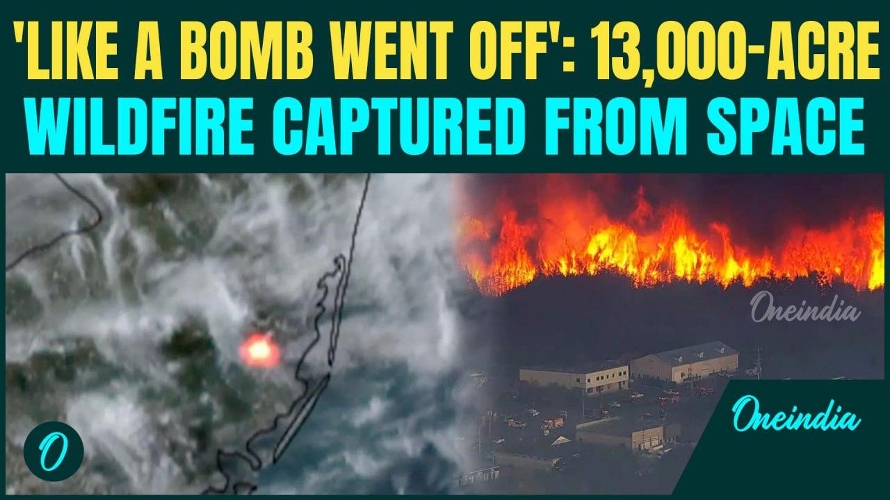
A massive wildfire known as the Jones Road Fire is tearing through New Jersey’s Pine Barrens, burning over 13,250 acres and threatening thousands of structures.
Captured by NOAA’s GOES East satellite, the fire is so intense it’s visible from space, making it one of the largest wildfires in the state in over 20 years.
The fast-moving blaze, located in Lacey and Ocean Townships, has forced the evacuation of over 5,000 residents and prompted a state of emergency.
Officials warn the wildfire may soon become the largest in New Jersey’s recent history, with no signs of slowing.
#NewJerseyWildfire #USWildfires #NJFireToday #WildfireLive #OceanCountyFire #LaceyTownshipFire #PineBarrensFire #NJWildfireEmergency #GreenwoodForestFire #WhartonStateForest #BarnegatFire #NJBrushFire #FireEvacuations #ForestFireNJ #FirefightersNJ ~PR.152~HT.336~GR.124~


![Breaking: Another Massive Wildfire In USA| US Nukes In Danger As 11000 Acres Burns In New Jersey [Video]](https://video.newsserve.net/300/v/20250424/1408969822-Breaking-Another-Massive-Wildfire-In-USA|-US-Nukes.jpg)